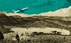
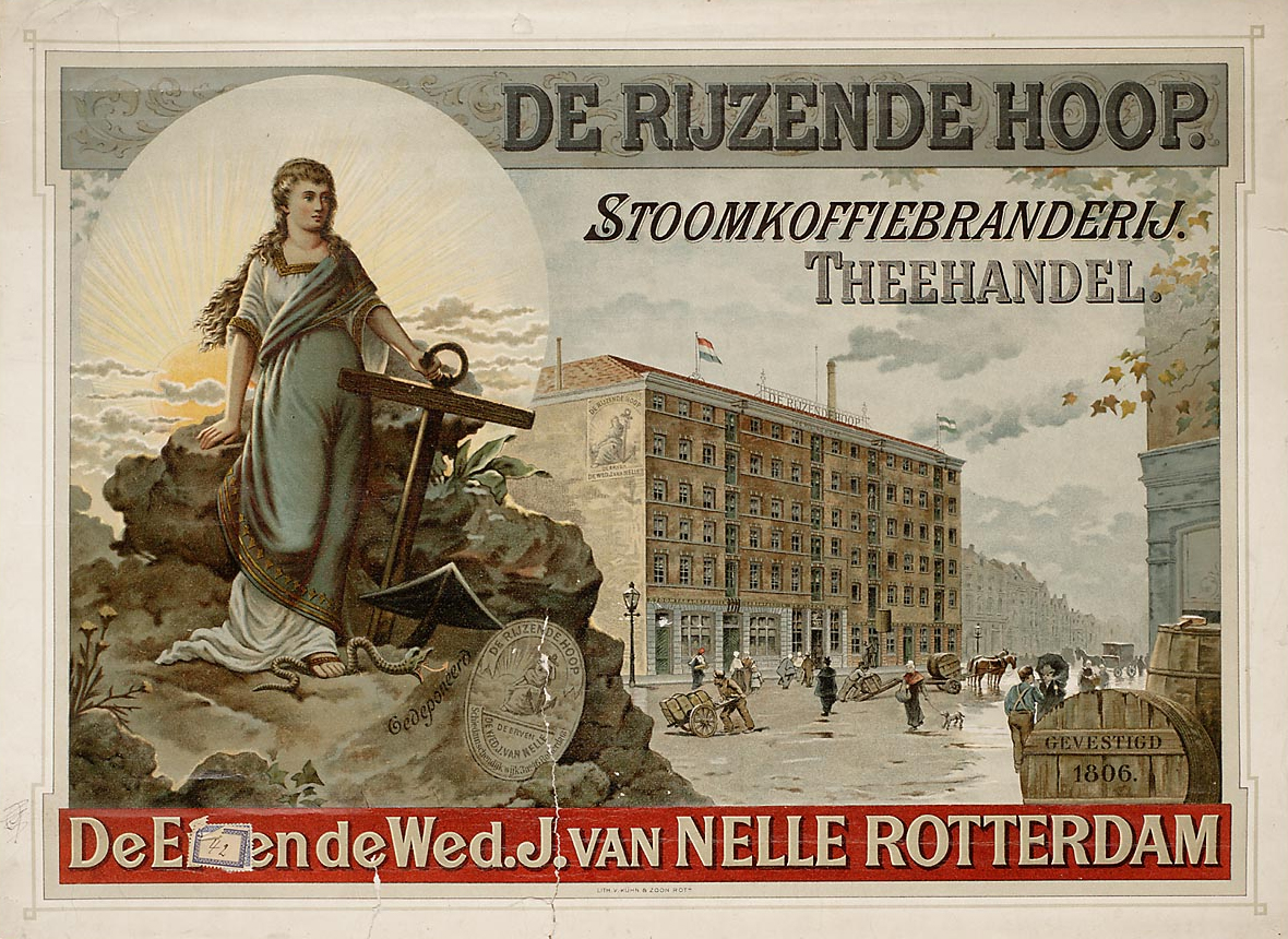
In the first part of my PhD thesis, I explored how Douwe Egberts, one of the largest Dutch producers of coffee and tea, used images of factories and cultivation landscapes in their advertising campaigns between 1900 and 1950. By applying the semiotic insights of Roland Barthes, and theories of visual archetypes formulated by art historian Ernst Gombrich, I examined each marketing image on four levels. Firstly, I determine what their objective characteristics were, such as colours and techniques. Secondly, I analysed what subjects were foregrounded in these images. This differed depending on the type of environment depicted; for example, factories were often shown with many smoking chimneys, included numerous means of transport and carriers, and had captions such as ‘steam roasting factory’. Images of coffee and tea cultivation landscapes, meanwhile, often included palm trees, sweeping hills, and identifiably non-European figures and buildings. In the last category, the entire commodity chain – almost every step between the cultivation and consumption of coffee – was depicted.
Thirdly, I explored the connotations evoked by these images, such as the use of exuberant colours to underscore the exotic nature of cultivation landscapes, or the depiction of activity around the factory or a focus on its huge scale, emphasising constant movement and vigour and associating steam power with an energetic modernity. Finally, I asked whether such images were unique to Douwe Egberts. They weren’t, with manufacturers of products as diverse as beer, cereals, champagne, pineapples, and tomato ketchup drawing on a similar repertoire of visual signifiers and motifs. By comparing Douwe Egberts’ commodity chain images with those deployed by other food-producing companies in the same period, then, it became clear that they reflected general myths that bore little relation to the harmful physical and geographical realities of coffee cultivation on the ground…
Coffee Cultivation in Nineteenth-Century Java
The worldwide consumption of coffee had increased dramatically over previous centuries, a development with enormous effects all over the globe. Thanks to detailed cartographic sources available for the Dutch East Indies (a Dutch colony consisting of what is now Indonesia), especially the so-called residentiekaarten, in the second part of my dissertation I was able to reconstruct the enormous spatial impact this cash crop had on the island of Java in the years up to 1890.
Coffee was first grown in Java in the late seventeenth century, and in the years leading up to 1890 the Dutch colonial government, based in the northern port of Batavia, implemented several cultivation regimes to maximise output and profit. These had devastating consequences, both for local people and ecology. This becomes clear through simple numbers. Around 1800, there were only c.110 coffee cultivation gardens in the Preanger, a mountainous region to the west of the island that was one of the first and most important coffee cultivation areas of the Dutch East Indies and even the world. However, by 1890 this had increased to some 1,500 plots with a much larger acreage. I put this data into a Geographic Information System (GIS) in order to perform detailed historical spatial analysis. The preliminary results are presented over the next three maps.
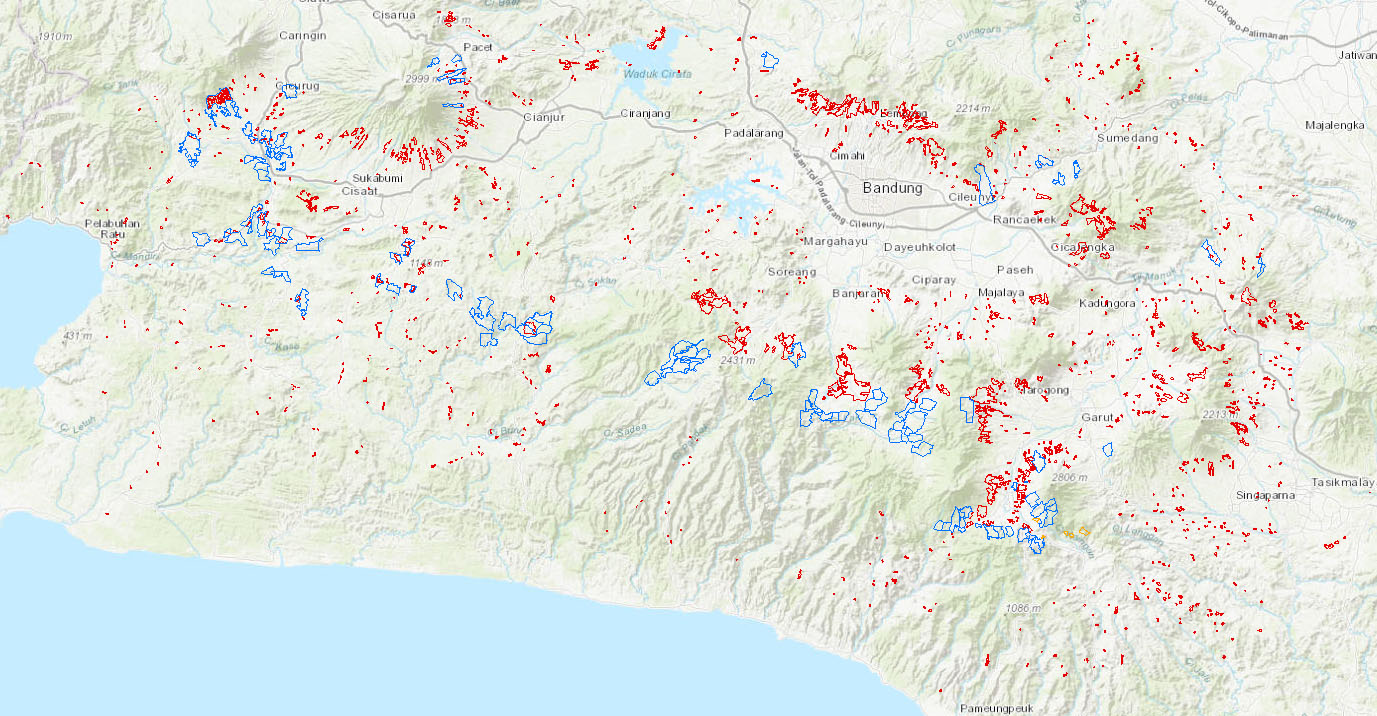
This map shows Preanger during the most intensive years of coffee cultivation around 1890. Depicted in red are the smaller coffee cultivation fields of the earlier phases of forced labour. Most of them were attached to specific villages and their inhabitants, who were required by the colonial authority to cultivate the fields and deliver the beans. The blue areas, on the other hand, indicate the ‘modern’ enterprises of European entrepreneurs. However, not all of these areas were designed for the production of coffee; some were intended to cultivate tea and quinine.
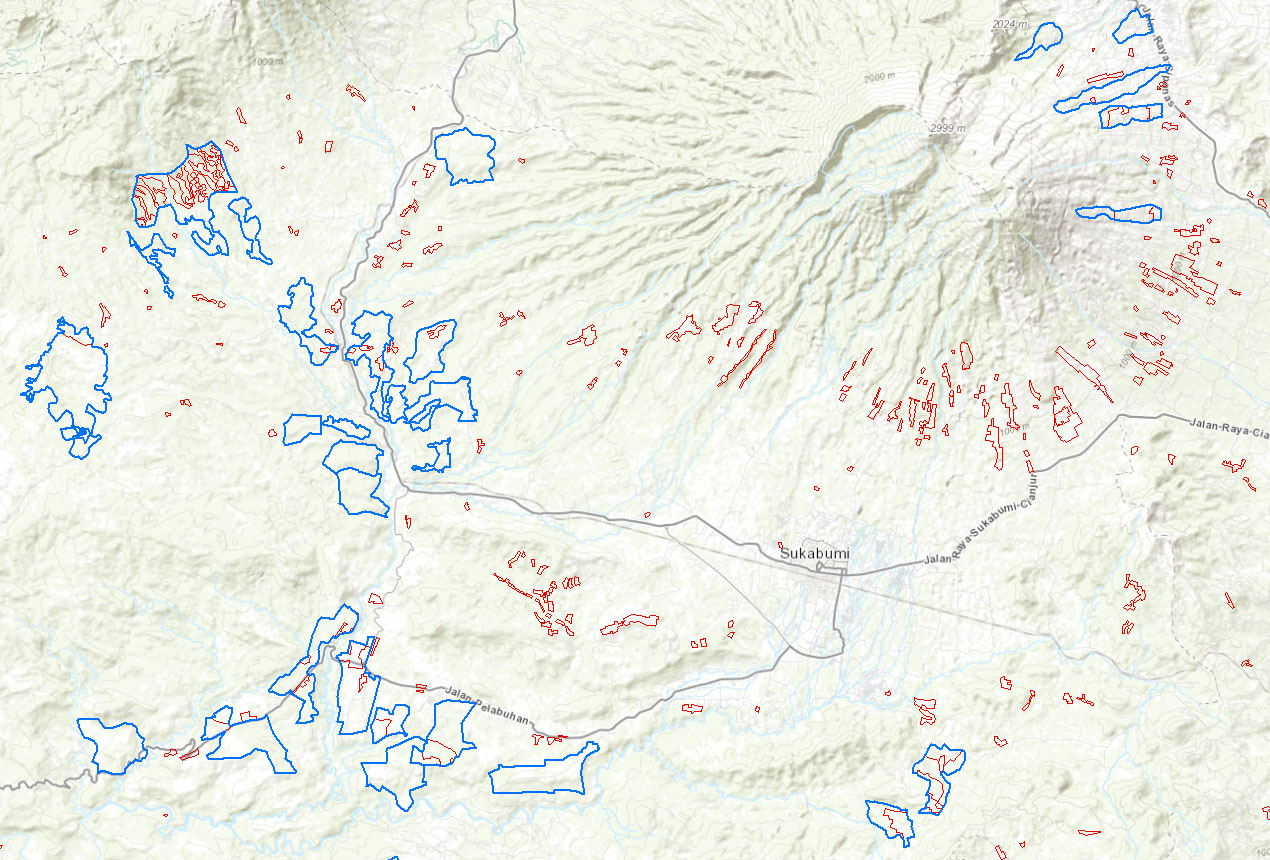
When zoomed in, it becomes clear that the different fields, phases, and cultivation systems all had their own spatial layout, distribution, locations, and average acreage. It is clear how scattered and small the original coffee fields were compared to the larger, later enterprises.
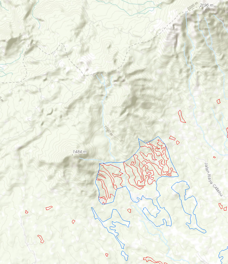
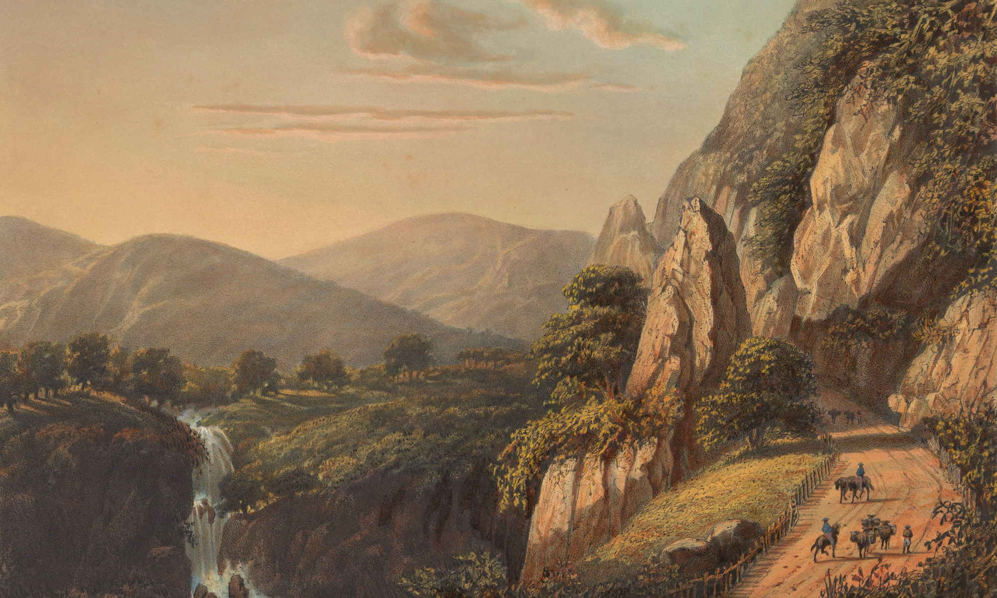
On an even more detailed scale, the geographical location of the coffee fields becomes clear, especially in relation to physical geography: altitude and relief were of great importance for the location choice of this crop, with most fields located on the flanks of volcanoes.
Exploited Landscapes, Landscapes of Exploitation
Now that the spatial layouts of the coffee fields are completely integrated into GIS, the next step will consist of adding non-geographical information to the system, in particular about which sub-phase of the Dutch colonial cultivation regime the plots belonged. An additional advantage of GIS is that some values can be calculated automatically, such as the number of fields and their average and combined acreage. In this way, it also becomes possible to measure the acreage that was used around 1890 for coffee cultivation and which areas were already abandoned because of the notorious devastating consequences for the soil.
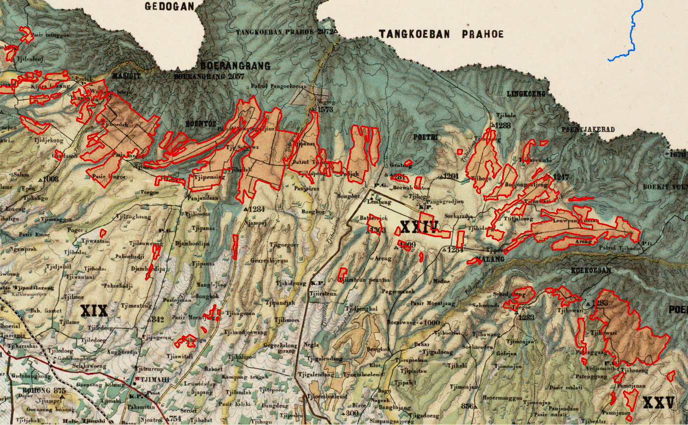
One of the most common techniques used to ‘solve’ this was to move ever higher on the volcano slopes where tropical rainforest was felled to accommodate new fields, as can be seen on this 1894 map of the Tankoeban Prahoe mountain ridge. The coffee fields – highlighted in red – are located between the forests (green) and Alang Alang (yellow), a grass particularly associated with soil erosion; the wooded gullies to the south of the map give a sense of the original extent of the forest.
Moreover, as the planting, cultivation, and transport of coffee was done by the forceful exploitation the local population, its expansion on Java also had major humanitarian consequences. Not only was the establishment of coffee plantations on mountainous terrain extremely labour-intensive, but for a long time local populations were not allowed to plant food next to coffee fields, had no protection from weather or wildlife during cultivation, and in some cases had to walk for forty days to deliver the harvested beans.
Further Reading
- R. Barthes, ‘Rhetoric of the Image’, in idem, Image, Music, Text (New York, 1977), pp. 32–51.
- J. Breman, Mobilizing Labour for the Global Coffee Market : Profits from an Unfree Work Regime in Colonial Java (Amsterdam, 2015).
- E. D. Dekker/Multatuli, Max Havelaar; or, the Coffee Auctions of the Dutch Trading Company (Amsterdam, 1860).
- C. Fasseur, Kultuurstelsel En Koloniale Baten: De Nederlandse Exploitatie Van Java 1840–1860 (Leiden, 1975).
- E. H. Gombrich, Art and Illusion: A Study in the Psychology of Pictorial Representation (New York, 1960).
- F. J. Ormeling, ‘De Topografische Dienst van Nederlands-Indië, Batavia 1864–1950’, Caert-Thresoor 36 (2017): 102–113.