Mapping Opium in Amsterdam
Stephen Snelders & Thomas van den Brink
Introduction
The opium map series consists of three maps depicting the eighteenth century, the period 1920-35, and the 1980s. The main challenge in creating the series was to design a database classification and legend symbology that was consistent over time while being flexible enough to incorporate change. Hence, our point of departure was the application of the commodity ecosystem framework that map researcher Thomas van den Brink is currently developing in his PhD research for the PortCityFutures consortium. This systemic approach enables us to map changes within commodity trade networks across time and space. It was inspired by the commodity chain concept, which assumes a discrete division of tasks/activities that can be classified and located in space: cultivation, transport, storage, trade, retail, and use/consumption.
The Maps
This approach was compatible with research undertaken by Annemarijn Douwes on apothecary shops in Amsterdam, represented on the first map. She determined the locations of pharmacies based on official records, especially a 1742 tax register and another official register of pharmacies. Despite the usual difficulties of determining exact locations due to extensive changes within the urban fabric, she was able to accurately identify 111 pharmacies and ten with an approximate location. This resulted in a clear distinction between the public (distribution) and private (use) parts of the system.
Following the illegalization of opium in 1920, the standard classifications of the commodity ecosystem came under pressure. In particular, there was a spatial clustering of activities within the chain. Trade, sale, and use no longer by definition happened at different places, or were operated by different actors. It became difficult to uphold the clear distinction in categories as prescribed by the ecosystem framework. The second map thus expresses the much more shifting and underground attributes of the later opium trade.
As this third map 1970–85 shows, new trade and consumption patterns replacing opium with the opiate heroin, and its adoption by a new culture of white and Surinamese users, led to a new and highly visible epidemic of drug use hitting the streets of Amsterdam, even though it was still concentrated in the same central areas as on the second map.

The challenge of applying consistent chain categories was not only the result of the illegality itself, but also originated from the sources that formed the basis for the (re)construction of the opium system. The locations in the second and third maps in particular were in large part derived from police reports. The character of this source, especially the reasons for their creation, had important consequences. Firstly, it can be assumed that the picture is far less complete than that for pharmacies. Secondly, the information was much vaguer, as the precise uses of particular opium locations was not always clear. It was therefore decided not to stick to the classical categorical distinction, but instead to combine them in one location and legend item: ‘Chinese lodgings’. New categories like smuggling and gang violence were also added to represent important new dimensions of the ecosystem.
The datasets were combined with contemporary maps that were as close as possible in time to the practices described. This helped to explain concentration and empty areas, since they correlated with (social) occupation patterns and port infrastructures. The latter also reflected changes in supply routes because of the canals constructed in the nineteenth century to link the port directly to the North Sea.
What Do the Maps Tell Us?
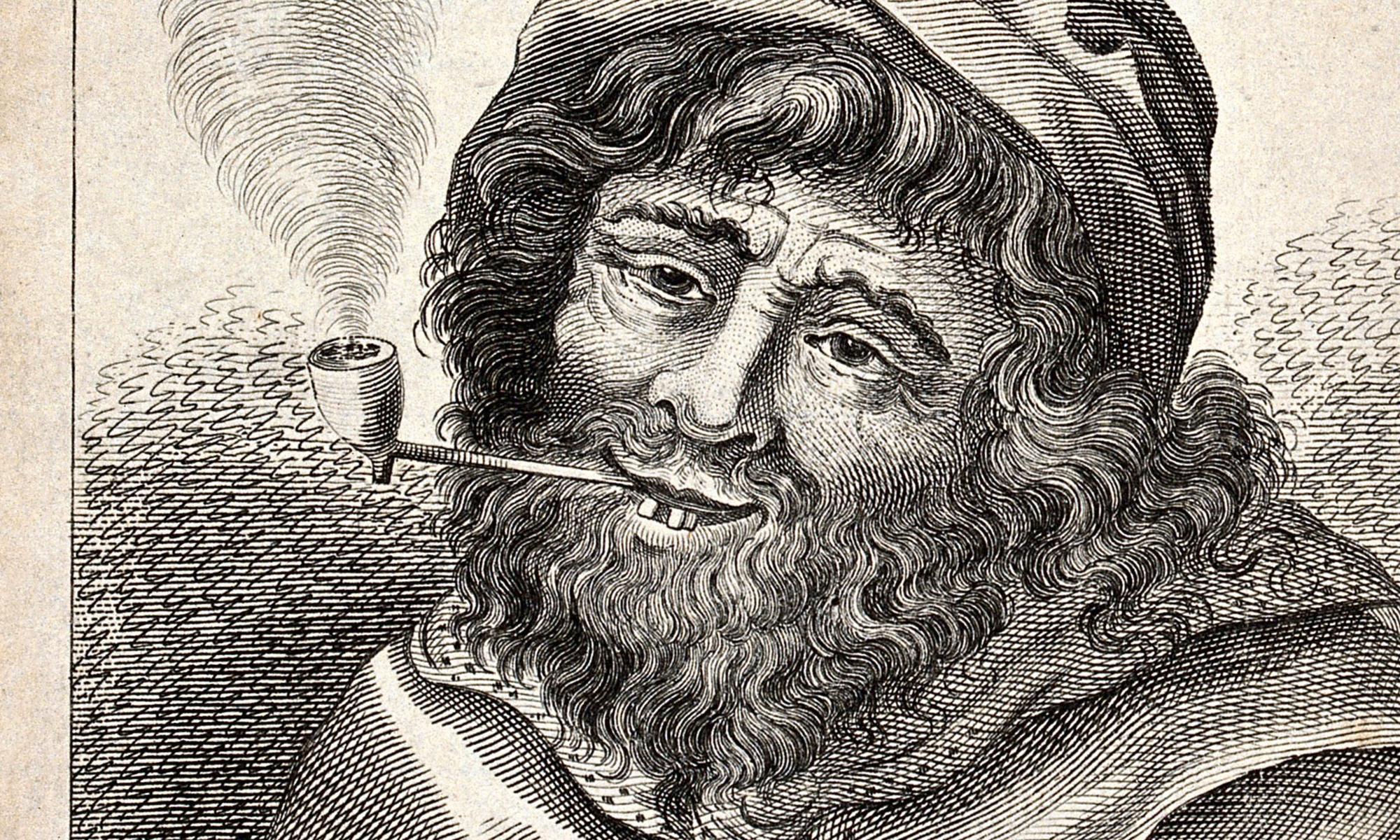
Today, opium is intimately associated in the public imagination with illegal drugs, Chinese opium dens, anti-social behaviour, and drug countercultures. These images have spread since the later nineteenth century through literature, media information campaigns around a ‘yellow peril’ threatening the West from China, and heavy opium use among Chinese labour migrants. However, this must not obscure the fact that opium use is an integral part of everyday life for Chinese workmen, as it had been for the general Amsterdam population between the seventeenth and nineteenth centuries. Indeed, before and during the 1800s, opium was also an essential drug in western medicine, and a painkiller, sedative, and sleeping drug used on a regular basis by urban populations.
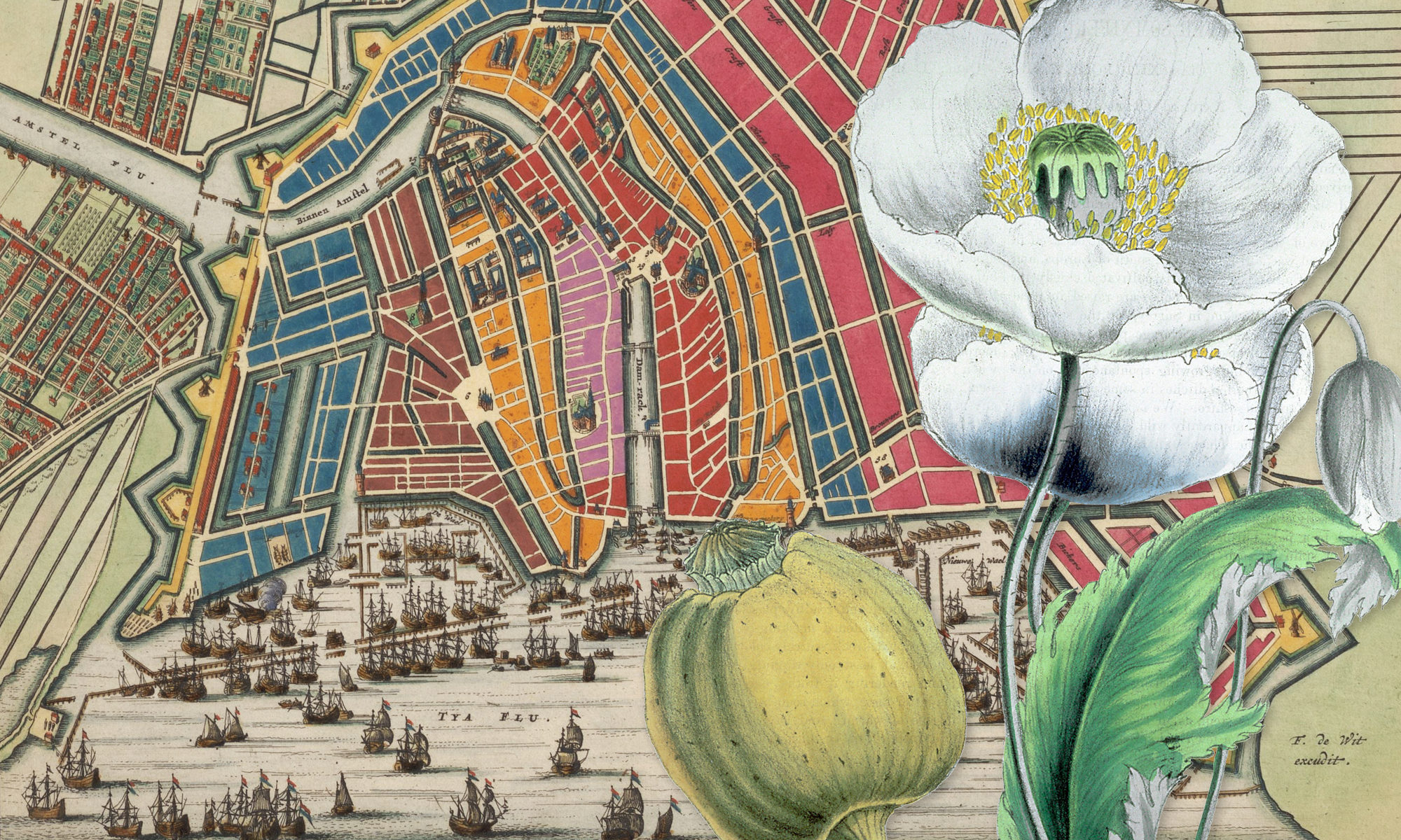
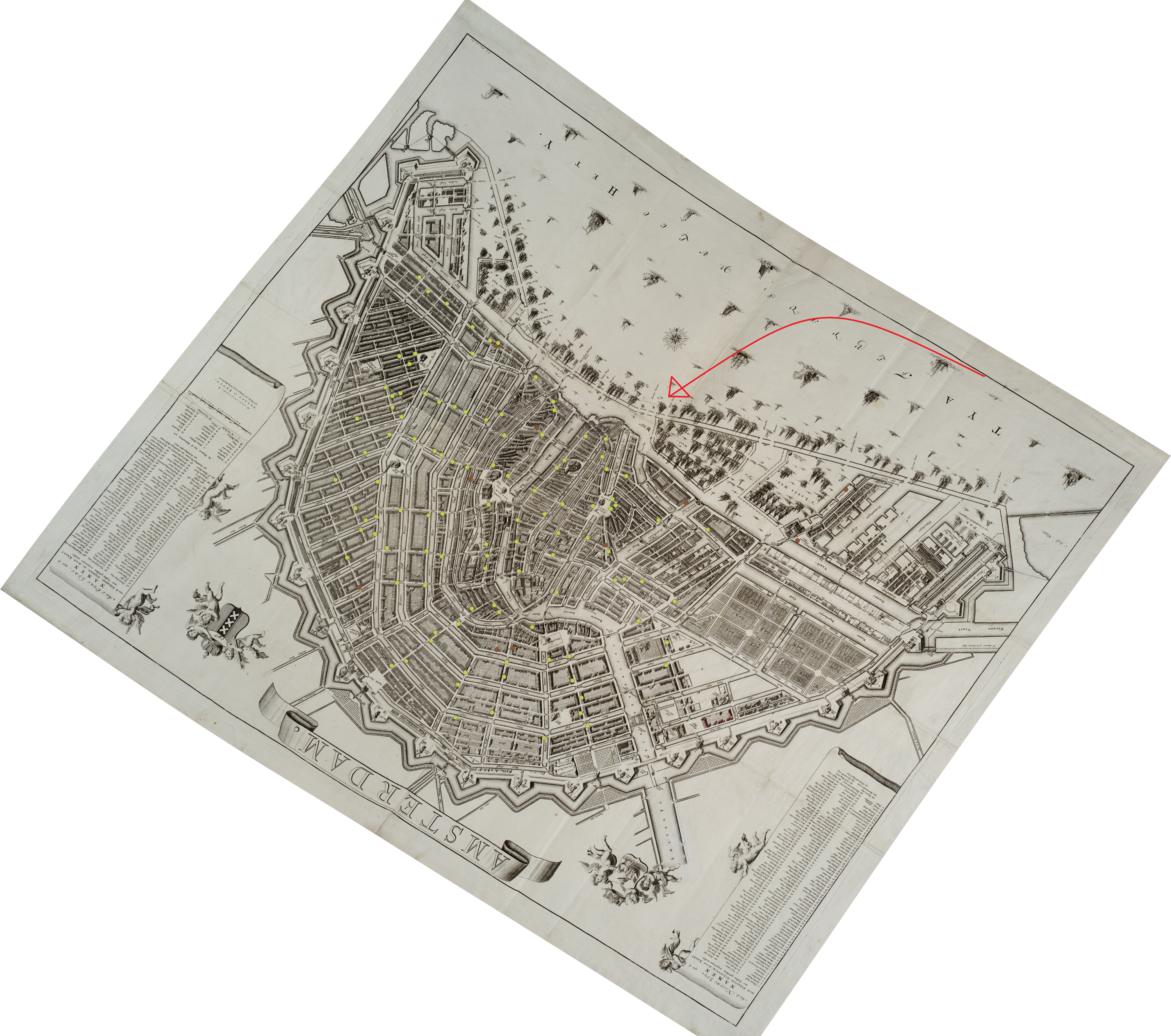
This change in the status of opium – from a well-respected medicine available without prescription to an illegal drug – punctuated in the Netherlands by the regulation of its production, distribution, and use in drug laws (the first Opiumwet of 1919 and the second of 1928), had a significant impact on the urban spaces of Amsterdam. This is illustrated by the two maps. The first map shows the city as it was in 1742. Opium pills and opium-based preparations such as laudanum (an alcohol tincture) and theriac were freely available in pharmacies throughout the city. The green dots on the map represent the pharmacies existing in that year. As a consequence, the availability of opium was evenly distributed throughout the whole of the city, with only two significant exceptions. There are few pharmacies in the small streets of the western neighbourhood called the Jordaan. This is a pattern that we also see with other retail stores. The Jordaan was a poor working-class neighbourhood where people had fewer resources for non-essential consumption. In the east we see that pharmacies are missing in the so-called Plantagebuurt, by that time a still largely uninhabited area of pleasure gardens, orchards, and the botanical gardens. There was also a non-problematic wholesale supply of opium from the east, especially from Turkey). Opium supplies were auctioned in the Brakke Grond in the centre of town, represented by the red dot.
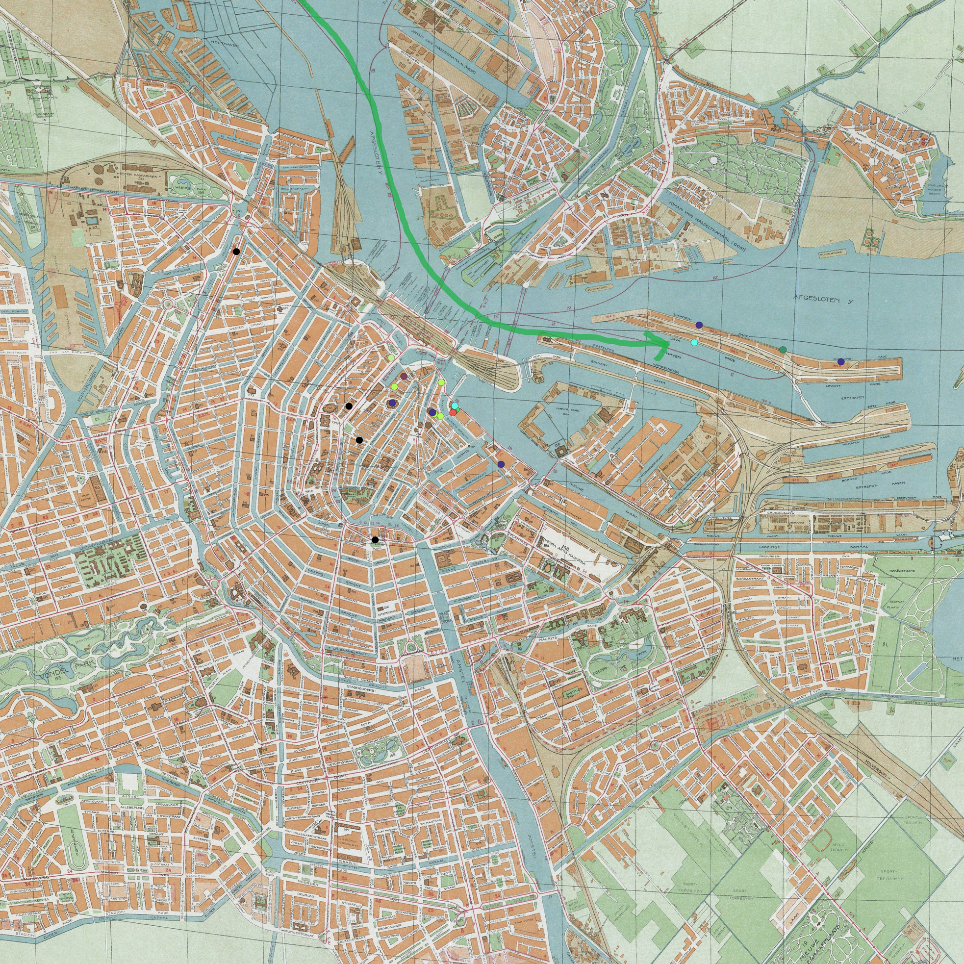
In the second map depicting Amsterdam between the two world wars the picture has totally changed. Opium is no longer freely available in pharmacies, but that does not mean it had disappeared. There is still overlap between trade and consumption in the harbour district, by now also the location of Amsterdam’s Chinatown. Raw and smokeable opium is smuggled in by Chinese sailors of the Dutch steamship companies, through their docks on the newly built Java- and KNSM-islands in the east of the harbour. From there it spreads into Chinatown, to Chinese lodgings, opium sheds, and gambling establishments. There is also a new element visible on this map: Chinese ‘secret’ societies fighting with each other over control of Chinese territories and infrastructure, leading to a suspected eleven murder attempts between 1920 and 1935. Apart from this fighting, however, the second map does not show any disorder in public spaces caused by opium users. Until the heroin epidemic of the 1970s, opiate use remained very much a private affair.